
Beginning in Alaska's largest city, this four-month tour will take you up to Prudhoe Bay in Alaska's Arctic Circle and all the way down to Ushuaia in the Tierra del Fuego province. This once-in-a-lifetime adventure will traverse the mountains of Canada and the United States, the canyon lands of the southwestern United States and Mexico, the tropical rainforests of Central America, and the widely varied and picturesque landscape of South America. You'll see native wildlife, flora and fauna indigenous to the various regions we'll be riding through. From mountain plains thousands of feet above sea level to canyon depths extending to thousands of feet below sea level, we'll explore the most scenic and unique national parks that showcase the jewels of the countries we will travel through. On our journey, we'll visit large cities serving as the political and cultural capitals of their countries, and we'll experience life in small burgs and villages barely large enough to register on maps. Enjoy local cuisines that are as varied and interesting as the peoples and cultures along our tour. Witness the diversity of natures beauty, including glaciers, geysers, waterfalls, volcanoes, canyons, arid plains, coast lands, lakes, picturesque valleys, and rich forests. Bring your sense of adventure and a good camera.
Trip Highlights
- [Leg One] -
- Anchorage and Denali National Park - Alaska’s largest city is a thriving seaport town in the south central part of the state. Due north of this fascinating city is the highest mountain peak in North America, Mount McKinley, which is home to Denali National Park. Its impressive peak, over 3.5 miles above sea level, dominates the landscape.
- Dalton Highway - This 414-mile road, built as a transport and supply road for the Trans-Alaska Pipeline System, passes through only three towns on its journey from the Elliott Highway to Deadhorse. You’ll see such sights as the Arctic Circle, Prospect Creek, the Continental Divide, and the Prudhoe Bay oil fields along the journey.
- The Arctic Circle - The Brooks Range offers breathtaking mountain views, and you may be able to spot grizzly bears and dall sheep. At the base of the mountains, the unique and scenic arctic tundra will offer you a chance to glimpse musk ox and caribou in their natural habitats.
- Prudhoe Bay and Deadhorse - While Prudhoe Bay hosts only five permanent residents, a population of several thousand temporary oilfield workers keep this small town thriving. The nearby community of Deadhorse offers more amenities and serves as the base for many workers servicing the nearby oil fields. This area is home to the longest day (lasting nearly 64 days) and the longest night (lasting over 54 days)
- Top of the World Highway - This scenic stretch of road passes along the crests of many hills, giving riders a bird’s-eye view into the valleys below.
- Dawson City and Whitehorse, Alaska - The annual tourist census exceeds the year-round population of Dawson City by over 4,500%! Its current population of roughly 1,300 hardly mirrors the 40,000+ inhabitants of the thriving community during the height of the Klondike Gold Rush in 1898. Whitehorse is the capital of Yukon, Canada, and is the largest city in the three northernmost provinces of Canada.
- The legendary Alaska Highway - Constructed during World War II, this road connects Alaska to the Lower 48 via Canada. This famous road runs from Dawson Creek, BC, to Delta Junction, AK, and is unofficially considered to be a part of the Pan-American Highway which extends to Argentina.
- The Icelands Parkway - This mountain highway parallels the Great Divide and offers some of the most spectacular scenery of the trip. You’ll see icefields, glaciers, lakes and waterfalls, along with bear, moose, caribou and other large wildlife.
- The Canadian Rockies - The Canadian segment of the North American Rocky Mountain range extends from Laird Plain in British Columbia to the Idaho and Montana borders of the United States. The Canadian Rockies form the easternmost segment of several mountain chains that extend from Alaska to the very tip of South America.
- Glacier National Park - Located in northwestern Montana near the Canadian border, this area became the tenth U.S. National Park in 1910. The alpine meadows, beautiful forests, rugged mountains, crystal-clear lakes, and hundreds of miles of trails make this park an experience to remember.
- Beartooth Highway - Dubbed “the most beautiful highway in America,” this winding road invites riders to enjoy the solitude and beauty of this road that follows the Beartooth Mountain Range from the Custer National Forest in Montana to the northeast entrance of Yellowstone National Park.
- Yellowstone National Park - The first national park in the United States, this one-of-a-kind area is home to many types of wildlife, ecosystems, mountains, lakes, canyons, and geothermal phenomenon, including the Old Faithful geyser.
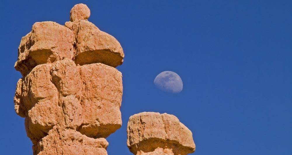
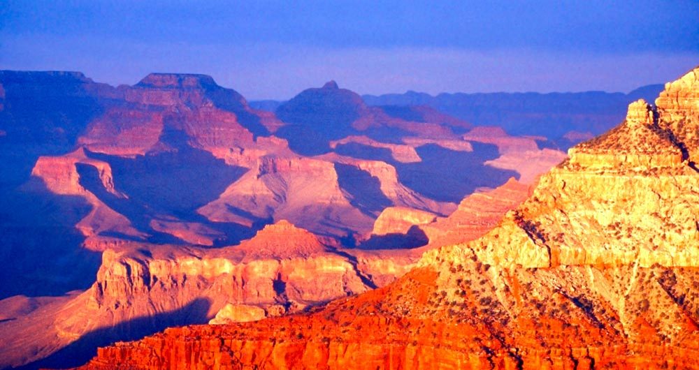
- Grand Canyon - Dominating northwestern Arizona, this canyon is 277 miles long, ranges between 4-18 miles wide, and reaches a depth of over a mile. The Colorado River, extending from the Rocky Mountains in Colorado to the Gulf of California just south of the Arizona-Mexico border, appears green next to the steep red and yellow sandstone cliffs as it snakes its way through the canyon.
- Historic Route 66 - One of the first interstate highways in the United States, this historic road gave American motorists and truckers a safe, well-maintained route from Chicago to Los Angeles. Also known as the Will Rogers Highway, this road was the major path of Midwestern migrants to California during the Dust Bowl of the ‘30s.
- Copper Canyon - This remote area of Chihuahua, Mexico, is a series of six canyons in the Sierra Tarahumana. The entire Copper Canyon system is larger than the Grand Canyon, and in some places it is also deeper. It forms the Copper Canyon National Park, part of the Mexican national park system.
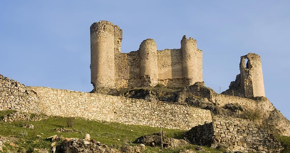
- Durango - The heavily mountainous state of Durango, Mexico, is well forested and has the second-lowest population density in the entire country. The Sierra Madre Occidental Mountains are rich in silver, bringing many Spanish silver miners to settle the area in the 1700s.
- The Colonial City of Guanajuato - One of the richest silver veins in the world was the product of the Valenciana mine located in this beautiful city. Before the silver strike, however, the indigenous people thought the place was only suitable for frogs—which how the name came to be.
- Costa Rica - Literally translated “the rich coast,” this country is located in the Central American isthmus. It borders the Caribbean Sea to the east and the Pacific Ocean to the west, and is home to the fifth highest mountain peak in Central America.
- Panama Canal - One of the largest and most difficult engineering feats in modern history, this man-made canal joins the Atlantic and Pacific oceans, allowing ships to cross Central America without having to sail completely around South America.
- [Leg Two] -
- Quito and Crossing to Peru - Quito is Ecuador’s political and cultural capital. It lies in a long, narrow valley in the Andes Mountains nestled between the Volcano Pichnicha and the Machangara River. Peru has been home to some of the most ancient civilizations in the world, including the Norte Chico and the Inca.
- Andean Mountain Scenery Around Huaraz - The Peruvian Andes are a narrow mountain chain roughly 110 miles north to south, but averaging only 12 miles east to west; yet within the range are sixty peaks ranging from 18,000 to 22,000 feet above sea level. This mountain range is home to glacial lakes, rivers, waterfalls, wildlife, and foliage.
- Nazca Lines - The high, arid Nazca desert with its dry, windless, mild climate created the perfect canvas into which the ancient Nazca civilization carved numerous laser-straight lines and hundreds animal- and human-shaped geoglyphs. Archeologists date the lines and figures back approximately 2,000 years.
- Peruvian Coastal Road - This is a rich and picturesque part of the Pan-American highway that stretches from Alaska to the southern regions of South America. This scenic stretch of highway features fantastic glimpses of wildlife (especially exotic birds) rice paddies, banana plantations, and inviting beaches.
- Crossing the Andes - The Andes Mountains form a contiguous mountain chain that parallels the western coast of South America for over 4,000 miles. Because the Andes are rich in flora and fauna, they offer greater ecological diversity than almost any other single location on earth.
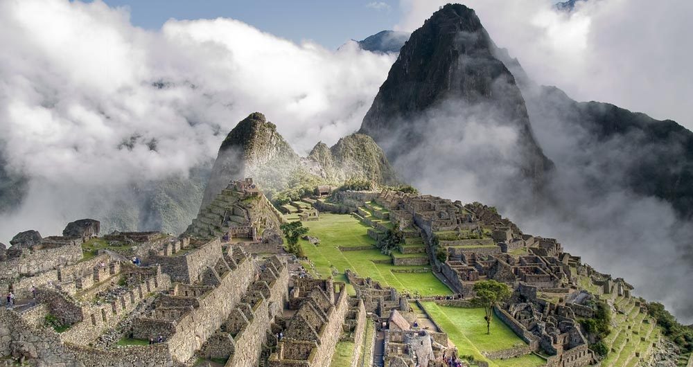
- Machu Picchu - Often referred to as the “Lost City of the Incas,” this picturesque, pre-Columbian Inca site has come to be identified as one of the most familiar symbols of the Incan Empire.
- Lake Titikaka - The largest lake in South America is located on the border of Peru and Bolivia. This lake sits 12,000 feet above sea level, making it one of the highest, commercially navigable lakes in the world.
- Riding the High Altiplano - Spanish for “high plain,” the Altiplano is where the Andes mountains are at their widest. With the exception of Tibet, the Altiplano is the most extensive high plateau on earth.
- Salar de Uyuni - This is the world’s largest salt flat and is home to mining operations for both salt (extracting over 25,000 tons of salt annually) and lithium for batteries. This area also serves as a breeding ground for three species of South American flamingos.
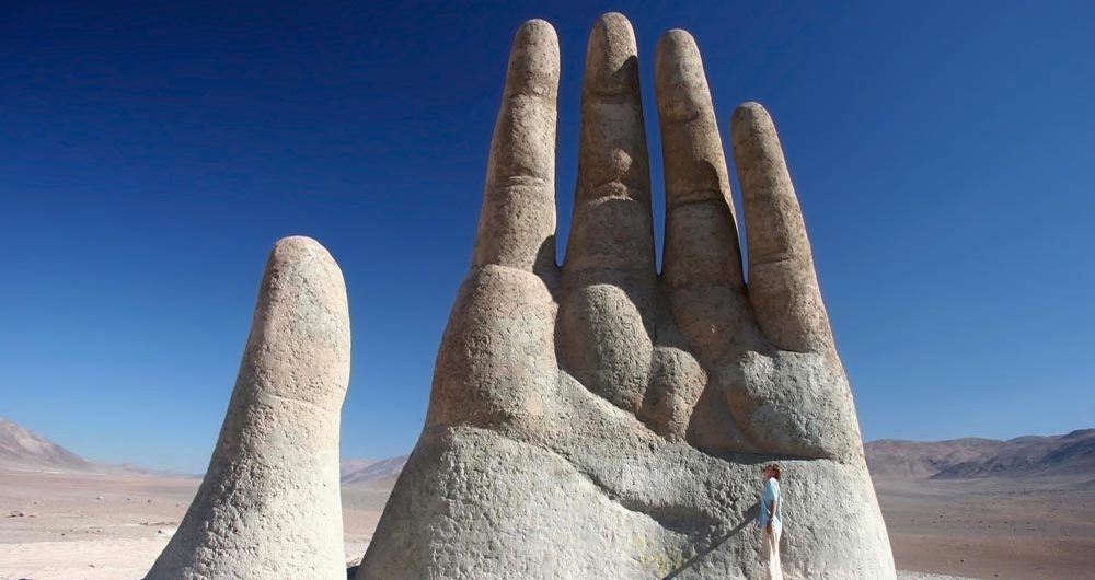
- San Pedro de Atacama - Overlooking the Licancabur volcano, this town in Chile houses one of the world’s most significant archeological museums. Nearby native ruins give tourists a look at pre-Columbian cultures, and the stargazing is unparalleled in South America.
- Scenic Seven Lakes Drive - Breathtaking views of crystal clear rivers, alpine lakes, and towering snow-capped peaks can be seen on the Seven Lakes Drive through the Nahuel Huapi National Park. It is truly one of the most magnificent riding experiences on earth.
- Circuito Chico - The “Short Circuit” follows the shoreline of the magnificent Nahuel Huapi lake toward the Chilean border. There are several tourist stops, sight-seeing vistas, and photo opportunities along this route.
- The Legendary Carratera Austral - Running 770 miles from Puerto Montt to Villa O’Higgins through rural Patagonia, this road has been a work in progress for over thirty years and was designed and constructed to connect many remote communities in Patagonia.
- Fitzroy Range Near El Chalten - One of the most picturesque mountains in Patagonia, the astounding scenery of this range rivals anything in the world.
- The Moreno Glacier - The 97-square-mile icefield is the world’s third largest reserve of fresh water, and it is one of only three Patagonian glaciers that is not retreating. It is located in the Los Glaciares National Park and is one of the primary tourist attractions in the Argentine Patagonia.
- The Infamous Ruta 40 - Throughout the 3,125-mile length of this road, it passes through 20 national parks, crosses 18 rivers, and traverses 27 Andes passes. Just a few of the attractions along this road are the Cueva de las Manos with cave art dating back thousands of years, the Los Glaciares National Park, and the Calchaqui Valleys.
- Torres del Paine - The Torres del Paine National Park encompasses mountains, lakes, glaciers and rivers in southern Chile. It transitions between the Magellanic subpolar forests and the Patagonian Steppes.
- Tierra del Fuego - Spanish for “Land of Fire,” the Tierra del Fuego is an archipelago, which is separated from the southernmost tip of the mainland of South America by the Strait of Magellan.
- Land’s End, Ushuaia - Known as the southernmost city in the world, Ushuaia is the entrance door to Antarctica. It is the capital city of the Tierra del Fuego, and the place where mountains, glaciers, forest and sea meet. And it is the end of our journey.